
A flying bird almost always looks higher than it actually is. The main reason is optical: your visual system loses its reliable depth anchors the moment a bird leaves the ground and moves against a featureless sky, so it defaults to perceptual shortcuts that systematically overestimate altitude. Add telephoto lens compression, atmospheric haze, silhouette contrast, and the sheer small angular size of a distant bird, and you get a consistent upward bias in perceived height. The bird has not necessarily climbed into the stratosphere, your brain has just run out of good reference points.
Why a Flying Bird Appears Higher: Perception vs Reality, How to Tell
Marcus Chen
11 Aug 2026
Perceptual tricks vs. real altitude: a quick map of the causes
It helps to split the causes into two clean buckets before going deeper. One bucket is perceptual and optical: everything that happens in the gap between the bird's true position and what your eye or camera registers. The other bucket is physical: the bird really is at a high altitude, for reasons rooted in its biology, the weather, or its behavioral needs. Most of the time, when you feel surprised by how high a bird seems, you are dealing with the first bucket.
| Cause type | Examples | Correctable by observer? |
|---|---|---|
| Perceptual / optical | Angular elevation misread, loss of ground reference, size-distance scaling, contrast, silhouette | Yes — using field geometry and reference objects |
| Camera / lens artifact | Telephoto compression, crop-sensor zoom, HDR processing, autofocus hunting | Yes — understanding your gear and shooting angle |
| Atmospheric / optical | Aerial perspective haze, atmospheric refraction, looming/superior mirage effects | Partially — awareness reduces error; refraction is measurable |
| Physical / real altitude | Thermal soaring, migration layers, escape climbs, wind exploitation | N/A — the bird is genuinely up there; use instruments or trigonometry to confirm |
Why your eyes misjudge height in the first place
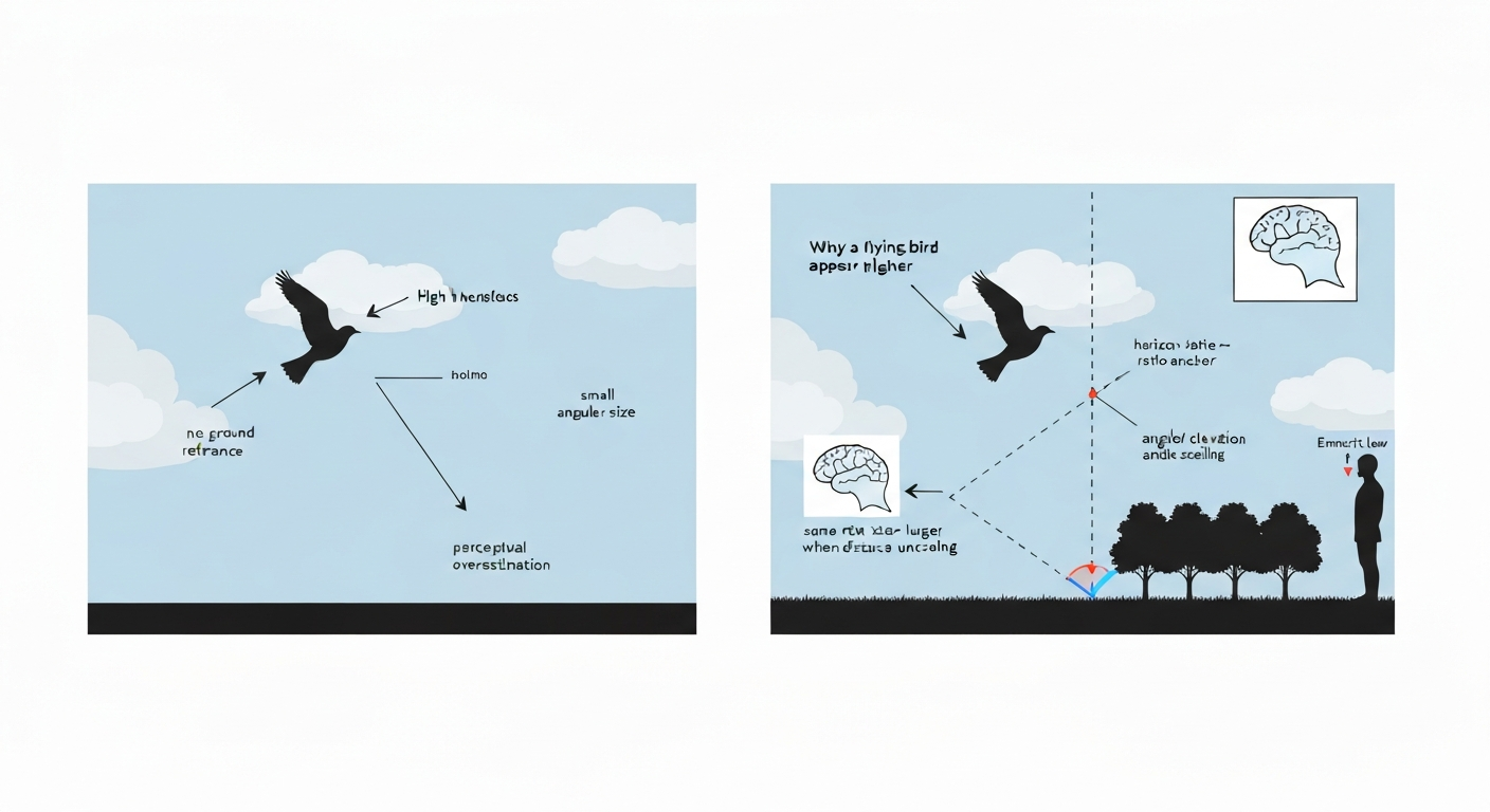
The human visual system is brilliant at judging distance and height when it has a ground plane to work with. J. J. Gibson's ground theory of space perception explains this with the horizon-ratio relation: your brain divides the visual scene into the portion of an object above the horizon and the portion below it, and uses that ratio against your own eye height to anchor perceived distance and scale. A sparrow standing on a lawn gives you all of that. The same sparrow once airborne, set against a blank grey sky, has stripped away every ground-surface cue. Your brain is now estimating altitude using a much weaker set of signals, and it consistently overshoots.
Emmert's law ties into this too. The same retinal image subtended by a small distant object is interpreted as physically larger (and therefore farther and higher) when perceived distance is uncertain. A distant buzzard covering roughly the same angular arc as your thumbnail nail could be 200 m up or 600 m up, and your visual cortex, lacking a metric anchor, will tend to resolve that ambiguity toward the larger, more distant interpretation. That is why birds against sky almost always seem farther above you than they are.
Perspective, viewing angle, and horizon cues
Angular elevation is the angle between your horizontal sightline and the line from your eye to the bird. A bird at 45 degrees of elevation and 200 m horizontal distance is only 200 m above you, but because 45 degrees feels steep, and because we have no everyday ruler in the sky, people routinely overestimate that height by a factor of two or three. The problem compounds when there is no horizon visible: standing in a woodland clearing, or on an overcast lowland day with no clear sky-horizon boundary, removes the single most powerful distance anchor the visual system has.
Height-in-the-visual-field is a related pictorial cue. Objects placed higher in the visual frame tend to be judged as more distant, because on the ground plane, things farther away project higher in the visual field. That heuristic works well for ground-based objects. Applied to a bird climbing through frame above the horizon, it reads as even greater altitude than is geometrically warranted. Research on background surface and horizon effects confirms that removing or misidentifying the horizon dramatically increases distance-and-height misestimation for small, unfamiliar-sized objects, which describes every bird you have ever tried to gauge at range.
Motion, parallax, and size cues
Motion parallax is one of the most powerful monocular depth cues available once you are beyond the range where binoculars stereopsis works. It works by comparing the relative speeds of objects at different depths as you or the target moves. A swallow banking low over a field will show rapid parallax shift against the background hedge: close, fast, low. A red kite circling high on a thermal moves against the sky with almost no parallax shift at all, background is uniform, your own head movement is negligible relative to the bird's range, and the motion cue collapses. That absence of parallax information is itself misread as confirmation of extreme altitude.
Binocular stereo depth cues, while excellent at close range, fall off fast. Useful stereoscopic depth for a small target like a bird typically degrades to near-uselessness somewhere around a few hundred metres, depending on target size and lighting. Experimental work on depth cue ranges has found that pictorial cues (horizon, ground surface) remain effective out to roughly 1.1 km, while motion parallax works to around 660 m and binocular disparity to around 528 m. So for any bird more than a few hundred metres up, which includes virtually all soaring species in daylight, you are operating almost entirely on pictorial and angular cues, both of which favour overestimation.
What your camera or phone is doing to make things worse
If you have ever photographed a raptor with a telephoto lens and been surprised how high it looks in the frame compared with your naked-eye memory of the scene, you have experienced telephoto compression. This effect is primarily geometric, not optical magic: using a long focal length from a greater standoff distance to keep the bird filling the same portion of the frame causes background distances to subtend a smaller fraction of the total scene geometry. The sky behind the bird looks more uniform and more distant. Everything appears vertically compressed or stretched, depending on orientation, and a bird that was perhaps 150 m above the canopy can look easily 400 m up.
Smartphone processing adds another layer. Modern phone camera pipelines merge multiple frames using HDR+, Smart HDR, or equivalent systems before you see the image. Burst alignment, noise reduction, and computational sharpening all alter local contrast and edge sharpness around small distant objects. A bird that was rendered as a soft blob by genuine atmospheric blur may emerge from the processing pipeline looking sharper and better-defined than it was optically, effectively making it appear closer and more distinct, but its apparent position in the frame (and therefore its apparent height) remains anchored by the compressed telephoto geometry. Autofocus hunting on a moving bird against sky can also create momentary focus breathing that distorts apparent size mid-clip.
Quick camera and phone tips for reducing height-distortion
- Include a horizon or a tree line in at least one reference shot so you have a geometric anchor for comparing the bird's apparent altitude later.
- Note your focal length equivalent (35 mm) and shooting distance when the photo is taken — this lets you back-calculate angular elevation more reliably.
- Use your phone's built-in inclinometer or a bubble-level app to record the angle of elevation at the moment you spot the bird before raising the camera.
- Avoid maxed-out digital zoom: optical zoom compresses the scene more predictably than digital zoom, which adds artificial sharpening that distorts small-object apparent size.
- Shoot RAW where possible so post-processing contrast is under your control rather than the phone's automatic HDR pipeline.
Atmospheric and lighting effects
Even without a camera, the atmosphere itself bends light in ways that push a distant bird's apparent position upward. Standard atmospheric refraction near the horizon raises the apparent angular elevation of any object by roughly 0.3 to 0.6 degrees. That sounds small, but at the distances involved in birdwatching, half a degree of angular lift can translate to a perceived altitude difference of tens of metres. Near large water bodies or over sun-warmed plains, vertical temperature gradients become sharp enough to produce looming effects, technically called superior mirages. These can place a visually crisp, erect image of a distant bird noticeably above the bird's true geometric position, sometimes making it appear to hover in an otherwise featureless sky.
Aerial perspective is the subtler, everyday version of the same principle. Water vapour, dust, and aerosols scatter short-wavelength light and reduce contrast between a distant object and its background. A bird at 800 m in clear winter air looks sharper, darker, and perceptually closer than the same bird on a humid summer afternoon at 300 m. The hazy bird is judged as higher and farther away partly because its contrast is low, consistent with psychophysical evidence that reduced target-to-background luminance contrast systematically pushes perceived distance upward.
How silhouette, contrast, and background fool you
A bird seen as a sharp black silhouette against a white overcast sky is operating in the highest-contrast configuration possible. That high contrast pulls the perceived object nearer and makes it look larger, which your brain then reinterprets as greater altitude since the bird must be big to subtend that angle. Conversely, a pale bird (think of a snow goose or an ivory gull) against bright cloud cover has very low luminance contrast against its background. It reads as smaller, more distant, and higher. The perceptual asymmetry is real and measurable: brightness-contrast relative to the surround genuinely affects judged distance in figure-ground configurations.
Cloud layers complicate this further. A soaring bird threading between a bright cumulus base and a darker upper layer can appear to shift altitude as it crosses each boundary, even though it is maintaining level flight. Ground clutter directly below the bird, such as a busy treetop canopy or an urban roofscape, also degrades the depth reference that the ground plane would otherwise provide. When vertical reference is confused from below and the sky provides no anchor from above, perceived height becomes almost arbitrary, and almost always inflated.
This is also the root reason why you often cannot see a flying bird's shadow, a related question worth pausing on briefly. The shadow is cast onto uneven, cluttered terrain, is blurred by penumbra effects proportional to the sun's angular diameter and the bird's altitude, and has low contrast against a textured surface. A bird at 100 m AGL on a sunny day casts a shadow with a penumbra width of roughly 10–15 cm around its edges and a slight offset from the bird's true ground position depending on solar angle, but the blurring, background clutter, and contrast loss are usually enough to make it invisible to casual observation. The geometry of why shadows disappear is actually a close mirror of the geometry of why the bird itself looks higher than it is.
When the bird really is that high: physical altitude causes
All of the above assumes the bird is at a moderate altitude and your perception is inflating it. But some birds are genuinely at extreme altitudes, and it is worth knowing which and why. Soaring migrants, raptors, white storks, common cranes, pelicans, exploit thermal columns and orographic lift that can carry them several hundred to a few thousand metres above the ground. Radar studies show soaring migrants averaging around 640 m AGL during active migration, with thermals and ridge lift sometimes pushing individuals well above that. Passerines and swifts on nocturnal migration routinely occupy flight layers between a few hundred metres and about 2,000 m AGL, with synoptic tailwind events sometimes lifting concentrations to 3 km or more.
The species and context matter enormously. A house martin hawking insects over a suburban garden is probably 20 to 80 m up. A common swift screaming in a summer feeding flock is typically 50 to 200 m. A golden eagle thermalling over a highland ridge may be 800 m above the valley floor. A migrating osprey tracked by satellite over the Mediterranean can spend sustained periods above 1,500 m. None of those altitudes feel intuitive from the ground, which is part of why the perceptual errors described above compound so readily: we have no practiced calibration for bird altitude.
How to estimate true altitude in the field
The most reliable low-tech method is the trigonometric hypsometer approach, borrowed directly from forestry surveying. If you can estimate horizontal ground distance to the point directly below the bird, and measure the angle of elevation from your eye to the bird, height above your eye level is simply: distance × tangent(angle). Add your eye height (roughly 1.5 m for most adults) to get height above ground level. A phone inclinometer app can measure the angle; pacing or using a known landmark on a map can give the horizontal distance. It is not exact, but it is orders of magnitude more accurate than unaided height guessing.
- Stand level and note a visible landmark directly below (or close to below) the bird.
- Pace out, or use a map/GPS, to estimate your horizontal distance to that landmark.
- Use a smartphone inclinometer or clinometer app to measure the elevation angle to the bird.
- Calculate: height above eye = horizontal distance × tan(elevation angle in degrees).
- Add 1.5 m (or your actual eye height) for height above ground level (AGL).
- For birds moving rapidly, photograph them at a known angle and compute from the photo metadata and your recorded distance.
For research-grade measurement, biologging studies use high-frequency GPS tags (2 to 3 second fix intervals) combined with onboard barometric altimeters. The GPS reduces vertical noise dramatically over low-frequency logging, while the barometer catches fine-scale altitude changes between fixes, though barometric sensors carry systematic biases that need calibration against known reference altitudes. An empirical assessment (How to improve the accuracy of height data from bird tracking devices? An assessment of high‑frequency GPS tracking and barometric altimetry in field conditions (Animal Biotelemetry, 2023)) found that high‑frequency GPS fixes and barometric altimeters provide substantially better vertical estimates than standard low‑frequency GPS, though barometric sensors often need calibration to correct systematic bias. Two calibrated cameras with a known baseline can also triangulate a bird's three-dimensional position photogrammetrically, which is the computer-vision standard for accurate height extraction from imagery.
Comparing the causes: a practical guide to what you are probably seeing
| Scenario | Most likely cause of height overestimation | How to check |
|---|---|---|
| Distant soaring bird against open blue sky | Loss of ground reference + size-distance scaling (Emmert's law) | Estimate angle + horizontal distance; apply trig formula |
| Bird looks extremely high in telephoto photograph | Telephoto compression + background uniformity | Check focal length and shooting distance; include a reference object |
| Hazy day, bird seems very far above horizon | Aerial perspective reducing contrast; atmospheric refraction | Compare a clear-day shot of same species at same location |
| Sharp black silhouette appears huge and high | High contrast pulling perceived size up; size-distance reinterpretation | Compare silhouette angular size to known reference object |
| Migrating raptor visibly high for sustained period | Genuine altitude: thermal soaring, migration flight layer | Trigonometric estimate; if trackable, check radar/telemetry data |
| Bird near horizon seems strangely elevated or 'floating' | Superior mirage / looming from temperature inversion | Watch for vertical stretching or duplication of the image |
A brief note on 'high-flying bird' in culture and media
The phrase 'high-flying bird' carries obvious metaphorical weight beyond the literal biology, from the idiom for ambition and freedom through to its use in film and literature. For a focused explanation of the term and its perceptual implications, see high flying bird explained. Steven Soderbergh's 2019 film of that name uses flight as a sustained metaphor, and the ending has generated substantial discussion about what the film is really saying. For a focused breakdown of the film's finale, see High Flying Bird, ending explained High Flying Bird — ending explained. If you have arrived at this article from that direction, the perceptual science here is genuinely relevant: both the film and the bird share the same structural theme, that what appears elevated, what looks like it is operating at an altitude beyond reach, may be closer to the ground, and to practical human calculation, than it first seems. For a closer reading of the film's themes and conclusion, there are dedicated pages exploring the High Flying Bird ending and the broader narrative that are worth reading alongside this one.
Putting it all together
The consistent message across all these causes, visual, optical, atmospheric, and photographic, is that perceived bird altitude is not a reliable guide to actual altitude. Your visual system is doing its best with a genuinely hard problem: a small, fast, unfamiliar-sized object against a featureless sky, at distances that exceed the useful range of your best depth cues. The solution is not to distrust your eyes entirely, but to supplement them: anchor your estimates to known landmarks, measure angles when you can, understand what your camera is doing to the geometry, and recognise the specific conditions (haze, silhouette, telephoto framing, loss of horizon) that push the perceptual error highest. Once you know the pattern, you start seeing birds at their actual altitudes, and paradoxically, that makes the genuinely high fliers, the thermalling storks and the migrating swifts riding synoptic wind layers at 2,000 m, feel even more extraordinary.
FAQ
Why does a flying bird often look higher than it really is?
Because human distance and size perception relies on angular size and pictorial cues: a bird seen against featureless sky lacks ground-scale anchors (horizon or nearby objects), so its retinal image can be scaled as if it were farther away (Emmert’s‑law/size‑distance scaling). Binocular disparity and stereopsis give little reliable depth for small distant targets, so observers over‑rely on angular elevation and pictorial cues, which tend to bias perceived altitude upward.
What optical or perceptual factors make a bird appear higher?
Key perceptual/optical causes: 1) Missing horizon/ground cues — no scale anchor. 2) Emmert’s‑law/size–distance effects — unknown size leads to overestimation of distance. 3) Height‑in‑field / angular elevation — objects higher in the visual field are judged more distant. 4) Motion parallax and limited stereopsis at distance — depth cues are weak for small distant birds. 5) Contrast/edge sharpness and atmospheric optics (refraction/looming) — high contrast or mirages can make birds look higher or lifted.
How do atmospheric effects like refraction or mirages change apparent height?
Normal atmospheric refraction near the horizon can raise apparent elevation by tenths of a degree; stronger vertical temperature gradients produce looming or superior‑mirages that can lift, stretch or produce stacked images of distant objects. These effects are most important near the horizon or over hot/cold layers (sea, deserts) and can make a distant bird look higher or unusually sharp.
Can camera lenses or smartphone processing make a bird look higher?
Camera optics alter appearance mainly via viewpoint and framing. Telephoto 'compression' comes from using a long focal length from farther away (camera position), not from the lens magically changing 3‑D geometry. Phone image processing (HDR, sharpening, stabilization) can increase contrast and edge definition of a distant bird, which may change perceived size and distance, but does not change the bird’s true altitude.
Why don’t I always see a bird’s shadow on the ground?
Shadow visibility depends on lighting geometry, ground reflectance/texture and angular size. If the sun is nearly overhead the shadow falls close to the bird’s vertical projection and may be small or foreshortened; low-contrast ground (water, uniform surfaces) or soft diffuse light (overcast) reduces shadow contrast; at large heights the shadow is small and blurred by atmospheric scattering, and for distant/fast birds the shadow can be hard to resolve.
How can I tell whether a high look is perceptual or the bird is actually flying high?
Use external scale cues and measurement: if the bird is near identifiable ground features (buildings, trees, clouds with known altitude), you can compare angular sizes/positions. Move to get motion parallax (walk sideways) — near objects shift more relative to distant background. If you can measure horizontal distance and elevation angle, compute altitude with Δh = distance × tan(elevation). If none of these are available, assume higher uncertainty when the bird is silhouetted against empty sky.